Aerial images show land devastated by wildfire
Matt Bunn
BBC News, East Midlands

 Derbyshire Fire and Rescue Service
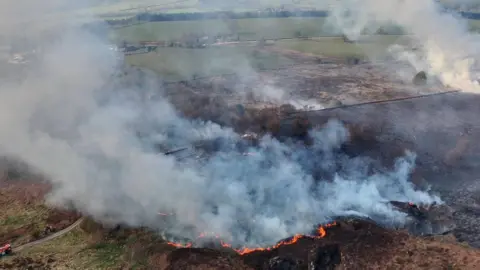
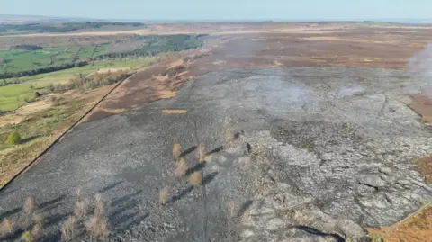
Aerial images have shown the devastation caused by a wildfire in Derbyshire's Peak District.
Eight fire crews were called to Beeley Moor at about 14:40 BST on Tuesday, with the blaze eventually being brought under control at 06:30 on Wednesday.
Derbyshire Fire and Rescue Service said the fire was caused by a controlled burn which was believed to have been affected by strong winds.
The blaze affected 45 hectares (111 acres) of land, a spokesperson for the service added.
 Derbyshire Fire and Rescue Service
Follow BBC Derby on Facebook, on X, or on Instagram. Send your story ideas to [email protected] or via WhatsApp on 0808 100 2210.
Related internet links