Housing plans halted for archaeological survey
 Google
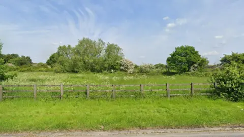
Plans for up to 40 homes to be built on a patch of land believed to be "rich in prehistoric remains" have been temporarily halted.
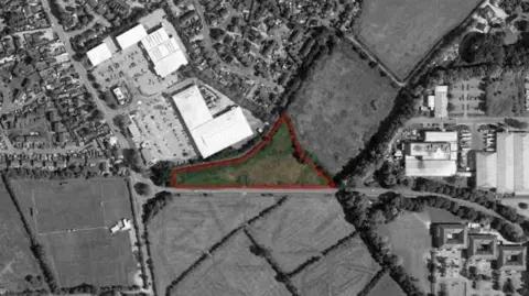
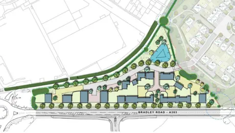
Drynham Lane Ltd submitted plans to Wiltshire Council on 7 January to build a housing development on agricultural land just north of the A363 near Trowbridge.
According to the proposals, the complex would create an "efficient use of the land" that "optimises density" and positively relates to its surroundings.
However, an archaeologist at the council has called for a geophysical survey to detect any undiscovered settlements on the site before permission can be granted.
 Drynham Lane Ltd
Neil J. Adam, assistant county archaeologist at the council, said the area is "known to be rich in later prehistoric and Romano-British field systems and settlement remains", the Local Democracy Reporting Service said.
"It is entirely possible that further, as-yet unrecorded, sub-surface archaeological features from these two periods exist within the site-features that would be severely impacted by groundworks associated with the proposed development," he added.
"I would therefore advise that the site be made the subject of a geophysical survey, followed by a trail trench evaluation in order to ground-truth the results of the remote sensing."
This work is to be carried out by qualified archaeologists.
The archaeologist noted: "Once these two pieces of work have been completed, I will then be in a position to offer you a fully-informed opinion on the archaeological potential of the site."
 BG Ltd
The site is located next to Elm Grove Farm, where Redrow Homes were recently granted approval for a development of up to 248 homes.
Also nearby, there are plans for a further 70 homes on land south of White Horse Business Park.
Drynham Lane Ltd said the two-storey dwellings on Drynham Lane would bring "clear social and economic benefits", including the delivery of a new market and affordable housing.
"The proposals will deliver housing to improve choice and competition in the marketplace and support growth," it said.
"The considerable positive economic benefit of the proposed development will clearly outweigh any minor disadvantage arising from the loss of agricultural land."
Wiltshire Council is expected to make a decision by mid-April.
Follow BBC Wiltshire on Facebook, X and Instagram. Send your story ideas to us on email or via WhatsApp on 0800 313 4630.
